OBSERVATION / 015
A forest between the channels.
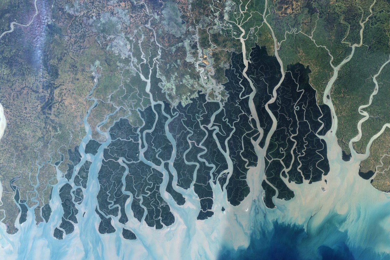
NASA Earth Observatory / Jesse Allen · UMD Global Land Cover Facility
- Location
- The Sundarbans / Bangladesh & India
- Image acquired
- November 24, 1999; November 17 and 26, 2000
- Platform / instrument
- Landsat 7 / ETM+
- Image type
- Multi-date satellite mosaic
Field notes
Branching channels divide dark mangrove forest into a maze of islands along the Bay of Bengal. The Sundarbans extends across southwestern Bangladesh and southeastern India, beside a lighter patchwork of farms and settlements.
This image combines three Landsat observations from November 1999 and November 2000. It is a mosaic, rather than a photograph of one moment. The contrast between forest, waterways, and neighboring land use reveals the shape of this low-lying coastal landscape.
Read NASA’s full account ↗This is dated source imagery. The homepage overlay is a graphic treatment, not a georeferenced measurement.