OBSERVATION / 014
A line against the tide.
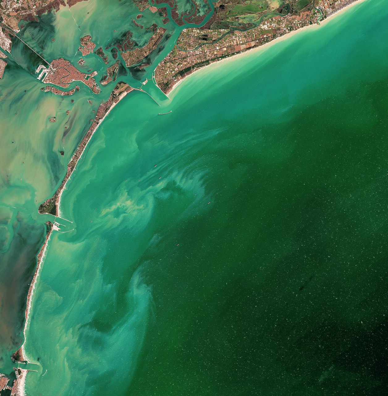
NASA Earth Observatory / Joshua Stevens · Landsat / USGS
- Location
- Venice Lagoon / Malamocco inlet / Italy
- Image acquired
- November 6, 2021
- Platform / instrument
- Landsat 8 / OLI
- Image type
- Satellite image
Field notes
A thin barrier separates Venice’s shallow lagoon from the Adriatic. In this November 2021 Landsat scene, movable floodgates at the Malamocco inlet were raised during a high-water event.
The MOSE system uses submerged gates that rotate upward to interrupt the flow through the lagoon’s inlets. Strong winds during this overpass stirred up sediment on both sides of the defenses. The scene records a short-lived operating state, showing how coastal engineering can leave a visible pattern in the water.
Read NASA’s full account ↗This is dated source imagery. The homepage overlay is a graphic treatment, not a georeferenced measurement.