The Sun. The field. The signal.
Keep an eye
on the Sun.
The bigger picture behind the bands.
Space weather can change radio propagation and satellite navigation. Follow NOAA’s observations and forecasts, then take that context back to the map.
Readings refresh every five minutes while this page is visible. Kp represents reported three-hour intervals; a refresh checks for new or revised NOAA values. Source timestamps are shown in UTC.
NOAA / LATEST OBSERVED SCALES
The current picture.
Loading NOAA observations…
GEOMAGNETIC / RECENT HISTORY
Watch the disturbance.
The latest eight reported three-hour Kp intervals. Copper bars mark Kp 5 or higher, the start of NOAA’s geomagnetic storm scale.
NOAA / planetary K-index ↗One index, one part of the picture.
Kp describes planetary geomagnetic disturbance. It is useful context for radio and aurora watching, but it does not predict every band or signal path.
OVATION / AURORA FORECAST
Follow the oval.
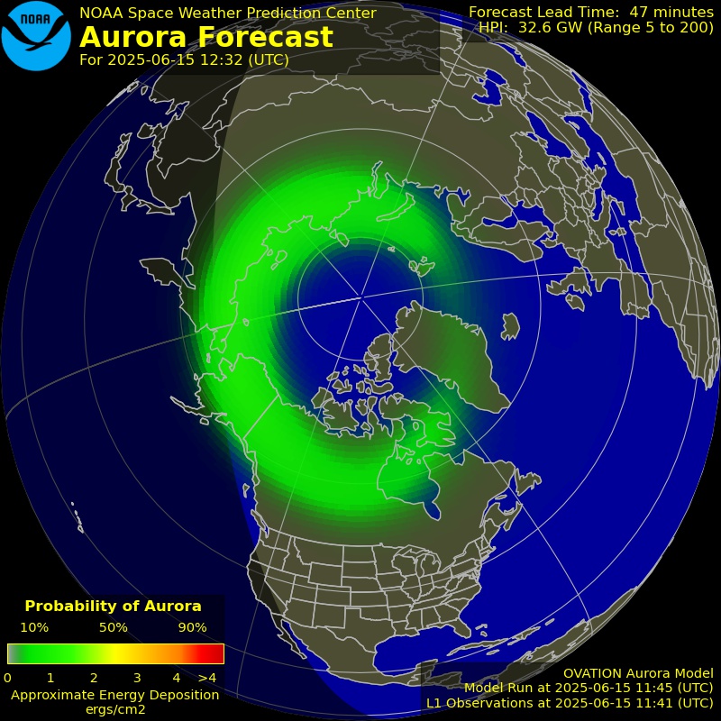
The forecast image is unavailable. Try Refresh readings or open NOAA’s forecast below.
READING THE SCALES
Different disturbances.
Different effects.
NOAA’s G, R, and S scales describe different phenomena. Level 0 here means below the first scale threshold, rather than a promise about every radio path.
G / geomagnetic storms
Disturbances in Earth’s magnetic field can affect HF propagation, satellite navigation, and aurora. The numbered storm scale starts at G1.
R / radio blackouts
These events are associated with solar X-ray flares and can disturb HF communication on Earth’s sunlit side. They are distinct from geomagnetic storms.
S / solar radiation storms
Elevated energetic-particle levels can affect spacecraft and radio communication in polar regions. NOAA tracks them on a separate scale.
Delayed or missing data
The page labels delayed readings and shows source times. A failed feed displays Unavailable. The current scale cards use observed readings, while the aurora map is explicitly a forecast.
KEEP EXPLORING
Follow another signal.
Choose your next desk.