OBSERVATION / 012
Rivers written in lava.
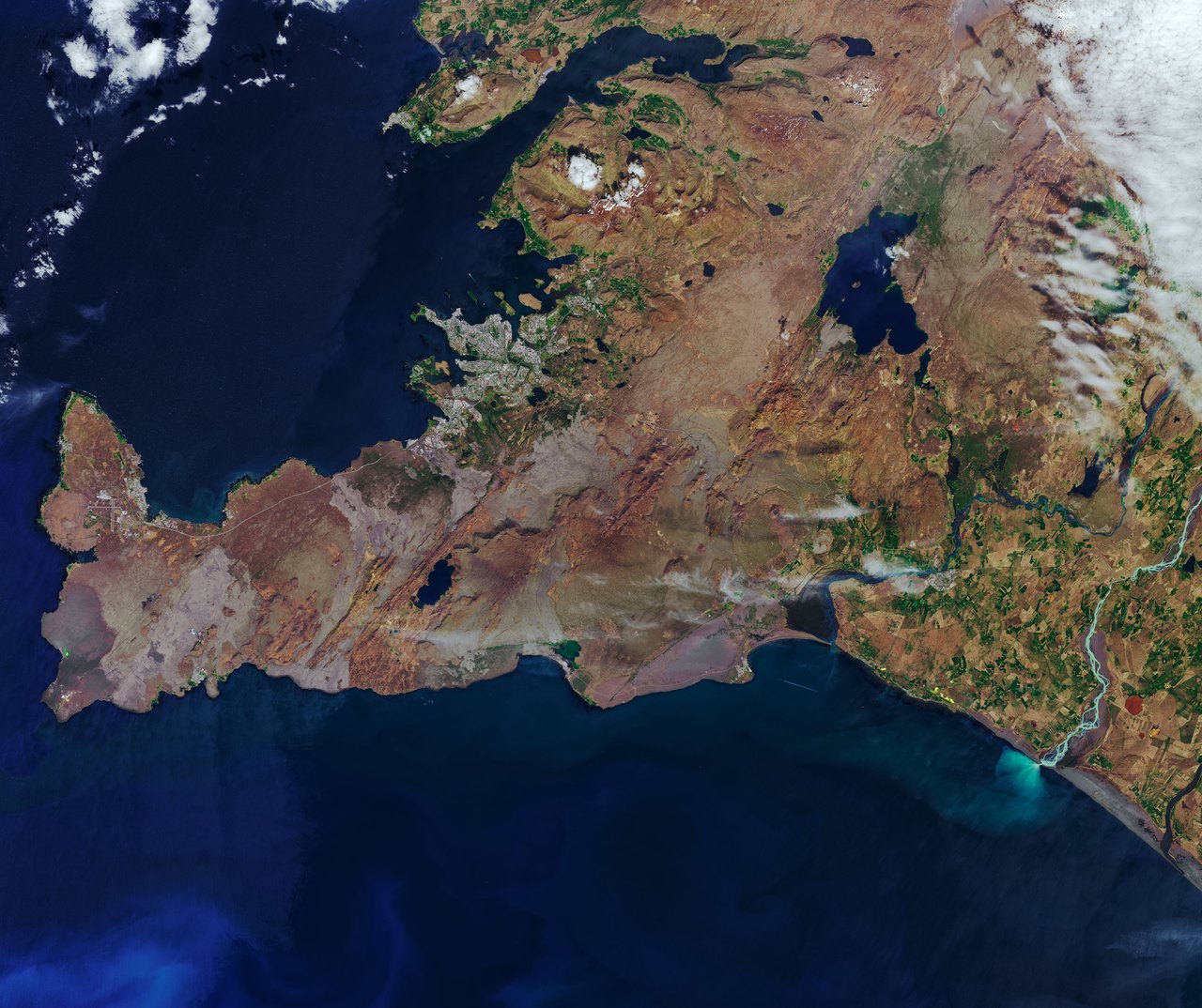
NASA Earth Observatory / Joshua Stevens · Landsat / USGS
- Location
- Southwest Iceland / Iceland
- Image acquired
- June 6, 2019
- Platform / instrument
- Landsat 8 / OLI
- Image type
- Satellite image
Field notes
Rivers cut across southwest Iceland before spreading sediment into the Atlantic. This June 2019 Landsat view places the Þjórsá and Ölfusá rivers within a landscape shaped by fire, ice, and moving water.
The two rivers once joined near the coast. A large lava flow about 8,700 years ago separated them, leaving each to follow a different side of the hardened lava. Pale water reflects suspended glacial sediment, while dark coastal patches include wet volcanic sand.
Read NASA’s full account ↗This is dated source imagery. The homepage overlay is a graphic treatment, not a georeferenced measurement.