OBSERVATION / 011
A harbor inside a volcano.
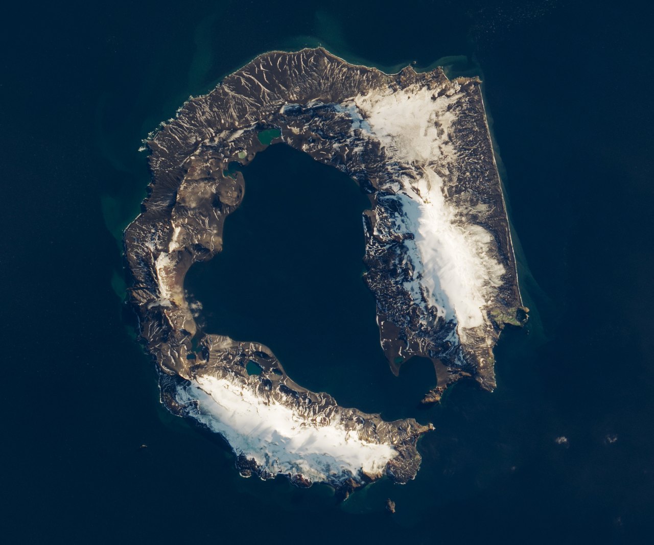
NASA Earth Observatory / Lauren Dauphin · Landsat / USGS
- Location
- Deception Island / Antarctica
- Image acquired
- March 23, 2018
- Platform / instrument
- Landsat 8 / OLI
- Image type
- Natural-color satellite image
Field notes
Snow-covered slopes wrap around a dark central harbor off the Antarctic Peninsula. The horseshoe outline belongs to Deception Island, a volcanic caldera that has filled with seawater.
A major eruption emptied part of the volcano’s magma chamber and the summit collapsed. A narrow opening now connects the flooded caldera to the sea, allowing ships to enter the volcano’s interior. This Landsat scene captures the island in early autumn, with exposed volcanic ground beside lingering snow.
Read NASA’s full account ↗This is dated source imagery. The homepage overlay is a graphic treatment, not a georeferenced measurement.