OBSERVATION / 008
A circle drawn around a mountain.
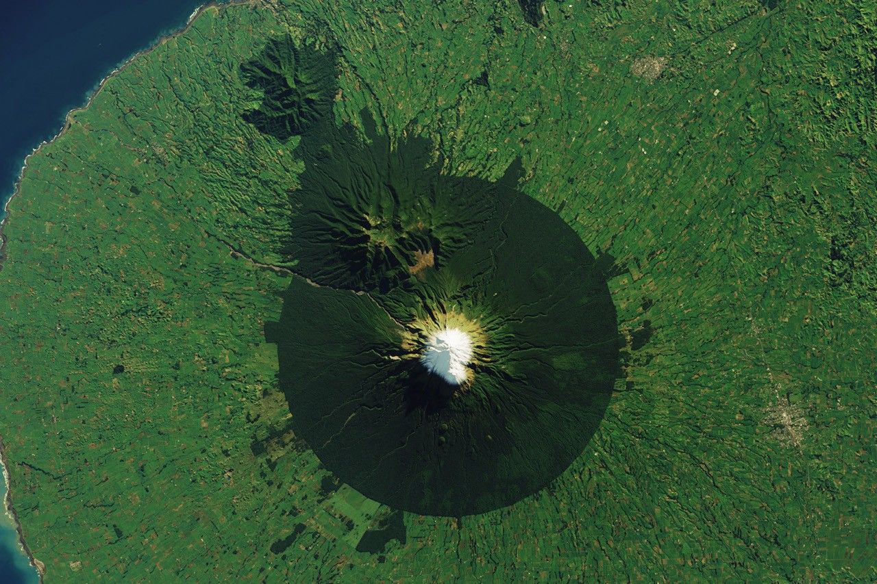
NASA Earth Observatory / Wanmei Liang · Landsat / USGS
- Location
- Taranaki Maunga / New Zealand
- Image acquired
- June 10, 2023
- Platform / instrument
- Landsat 8 / OLI
- Image type
- Satellite image
Field notes
A snow-capped volcano stands inside a remarkably precise ring of dark forest on New Zealand’s North Island. Beyond the boundary, lighter pasture makes the protected landscape unmistakable in this Landsat view.
The geometry reflects a human decision. A circular forest reserve around the summit was protected in 1881 and later became part of a national park. Vegetation also changes with elevation, so this single frame records both a conservation boundary and the mountain’s natural bands of habitat.
Read NASA’s full account ↗This is dated source imagery. The homepage overlay is a graphic treatment, not a georeferenced measurement.