OBSERVATION / 001
The Eye of the Sahara.
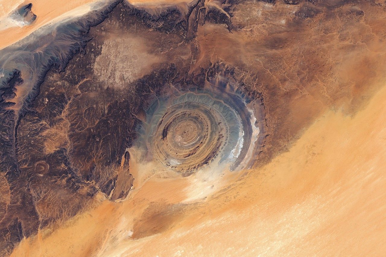
NASA Earth Observatory / Lauren Dauphin · Landsat / USGS
- Location
- Richat Structure / Mauritania
- Image acquired
- March 5–6, 2026
- Platform / instrument
- Landsat 9 + Landsat 8 / OLI
- Image type
- Satellite mosaic
Field notes
A ring of concentric ridges, roughly 40 kilometers across, stands out against the desert of Mauritania’s Adrar Plateau. Its geometry is much easier to recognize from orbit than from the ground.
The resemblance to an impact crater led to an early explanation that was later overturned. NASA describes the Richat Structure as an uplifted geologic dome, worn down at different rates as its layers of rock eroded.
Read NASA’s full account ↗This is dated source imagery. The homepage overlay is a graphic treatment, not a georeferenced measurement.